
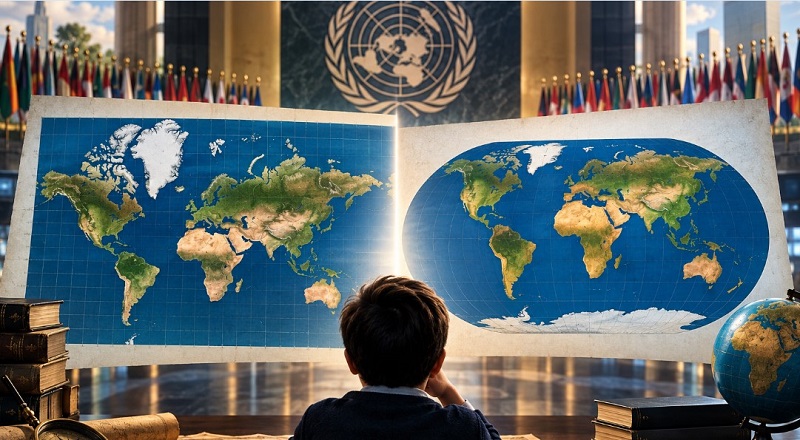
Maps are no longer merely geographical tools for displaying continents and countries; rather, they have become part of the way in which human beings construct their perception of the world around them. In this context, the United Nations took a notable step on September 4, 2026, when the General Assembly adopted Resolution A/80/L.104, entitled “Correcting the Map: Rebalancing Global Cartographic Representation and Promoting Equitable Representation of the World’s Regions, Particularly Africa.” The resolution was adopted by a wide majority of 164 votes in favor, one against, and six abstentions. It called on governments, schools, international organizations, and technology companies to increase the use of cartographic projections that represent the relative areas of continents more accurately, with particular reference to the Equal Earth projection.
The significance of this step does not lie simply in deciding to replace one map with another. Rather, it lies in reopening a broad scientific, political, and cultural debate over how we see the world. The Mercator projection, developed by Gerardus Mercator in the sixteenth century for maritime navigation, has remained one of the most widely used projections because of its ability to preserve directions and angles. At the same time, however, it exaggerates areas as one moves farther away from the Equator, making regions such as Greenland, Northern Europe, and parts of North America appear relatively larger than they actually are. By contrast, the Equal Earth projection was designed to preserve proportional relationships between areas, allowing Africa to appear much closer to its actual size than it does in conventional representations.
The Importance of the Issue
The resolution is of particular significance for Africa, which was at the heart of the initiative led by Togo on behalf of the African Group. The issue does not concern a geographical change in the continent’s size; Africa has not become larger because of the new map. Rather, it concerns removing part of the visual distortion that causes areas located at higher latitudes to appear larger, while regions closer to the Equator appear relatively smaller under the Mercator projection. For this reason, the United Nations described the initiative as an attempt to address the ways in which maps, through education, media, and technology, can influence collective perceptions of the world and the relative position and significance of its regions and continents.
However, the UN resolution does not mean that Mercator has been banned, nor does it require countries around the world to adopt Equal Earth. The United Nations itself explains that the Secretariat does not impose a single global projection; rather, projections vary according to the purpose, geographic region, and type of map. Every cartographic projection necessarily sacrifices certain properties in favor of others, whether area, shape, distance, or direction. Accordingly, the essence of the resolution is not to declare one “correct map” in opposition to a “wrong map,” but to emphasize the importance of selecting a projection appropriate to the purpose of the map, particularly when the comparison of areas and the proportional representation of continents are its primary objectives.
This development also demonstrates that the issue of mapping extends beyond cartography into broader questions concerning perception, awareness, representation, and equity in the production of knowledge. A map that people repeatedly encounter from childhood becomes part of their spatial memory and may influence how they perceive the size, location, and relative importance of continents. Thus, the debate brought back to the forefront by the United Nations is not merely about how to draw the world, but about a deeper question: Can the way the world is represented on a map influence the way we understand the world itself?
The Significance of the Issue
The Earth does not change when the map changes; what changes is the way in which we choose to represent it and perceive its characteristics. This is why the contemporary debate surrounding the Mercator Projection and equal-area projections, particularly Equal Earth, is significant. A map does not represent reality in a completely neutral or absolute manner; rather, it provides a scientific representation of reality based on a set of cartographic choices that determine which properties should be preserved and which may be sacrificed.
The Mercator projection has historically been associated with navigational maps because of its ability to preserve angles and directions locally, a characteristic that gave it major importance in the history of maritime navigation. This advantage, however, is accompanied by increasing distortion of areas as one moves away from the Equator toward higher latitudes. This becomes particularly evident when comparing the apparent areas of continents and regions on the map, with the comparison between Africa and Greenland being one of the most prominent examples.
A Neutral Perspective
The Earth did not change on September 4, 2026, but the way in which the world seeks to see it did. The debate over “correcting the map” has been associated with a call for cartographic representations that are better suited to showing the actual relationships between the areas of continents and regions, particularly when highlighting relative differences in area is a primary objective of the map.
At first glance, this may appear to be merely a change in the visual form of a world map. However, a cartography specialist understands that the issue extends far beyond appearance. Every world map is based on the selection of a particular cartographic projection, and this choice is linked to a fundamental scientific question: Which property of the Earth’s surface do we want to preserve when transferring it from a spherical surface to a flat surface or a digital screen? Accordingly, the debate over Mercator and Equal Earth is not about one map being “right” and another being “wrong”; it concerns the function that we want the map to perform.
Has the Mercator Projection Failed?
It would be incorrect to regard the Mercator projection as a failed projection simply because it produces significant area distortion at higher latitudes. When Gerardus Mercator developed his famous projection in the sixteenth century, one of the fundamental challenges facing cartography was meeting the needs of maritime navigation. Sailors needed a map that could help them determine directions and plot courses in a practical manner.
In this context, one of the most important characteristics of the Mercator projection emerged: its ability to preserve local angles. This allowed constant-bearing lines, or rhumb lines, to appear as straight lines on the map, giving the projection exceptional value for navigation. Mercator was therefore not a scientific error, but rather a cartographic achievement designed to fulfill a specific function—and it succeeded in doing so efficiently. Judging it independently of the purpose for which it was created represents an inaccurate reading of the history of cartography.
The Trade-Off Between Angles and Areas
No cartographic projection can preserve all the properties of the Earth’s surface simultaneously. The process of transferring the curved surface of the Earth onto a flat surface necessarily entails a trade-off between different properties. Consequently, preserving angles and directions in some projections comes at the expense of preserving areas.
The Mercator projection is not an equal-area projection. The scale of representation gradually increases as one moves away from the Equator, resulting in greater areal distortion toward the poles. Thus, not all regions on the map experience the same level of distortion. Areas close to the Equator differ from those located at higher latitudes, and the farther one moves toward the poles, the greater the exaggeration in the representation of areas.
Africa and Greenland: When Reality Differs from the Image
The paradox becomes particularly clear in the famous comparison between Africa and Greenland. Although Africa is approximately fourteen times larger than Greenland in area, their representation on a Mercator map may create a substantially different visual impression because Greenland is located at high latitudes.
The paradox does not lie in the Earth itself, but in the way the projection has chosen to represent it. The problem is not that the map is “false,” but that one property—preservation of angles and directions—has been achieved at the expense of another property: accurate representation of areas. This is where the importance of understanding the nature of distortion begins, rather than simply relying on a visual judgment of the map.
From Impression to Measurement: Understanding Distortion
In cartography, it is not sufficient to state that a particular map is “distorted” and stop there. Cartographic distortion is not merely a visual impression; it is a geometric and mathematical phenomenon that can be measured, analyzed, and represented scientifically.
One of the most important tools used in this field is Tissot’s Indicatrix, which helps explain the distortion resulting from projecting the spherical surface of the Earth onto a flat surface. Its underlying concept involves imagining a very small circle on the surface of the Earth and then observing what happens to it when projected onto a map. If no distortion occurs, the circle remains a circle at the same scale. If distortion occurs, however, it may become an ellipse whose size, shape, orientation, and ratio of its axes change. These changes can be used to determine the nature, magnitude, and direction of distortion at different locations.
Distortion Is Not Necessarily an Error
The importance of Tissot’s Indicatrix lies in its ability to move the discussion of distortion from the level of visual impression to the level of scientific analysis. Instead of simply stating that “the map appears distorted,” it becomes possible to identify where distortion occurs, its type, magnitude, direction, and causes. This demonstrates the value of cartography as a science that does not treat the map merely as an image, but as a geometric representation whose properties can be analyzed and measured.
One of the fundamental principles of cartography is that distortion is not inherently an error. If the objective is to produce a global map that preserves equal areas, we may accept a degree of distortion in shape or direction. If the objective is to preserve accurate angles and directions, we may instead accept some distortion in area. If the objective is to calculate distances accurately within a specific region, we may need a different projection suited to the characteristics of that region and the intended function.
The Right Question: What Is the Purpose of the Map?
This idea can be simplified by comparing a map to a camera lens. Not every lens is designed to photograph the same subject, nor does every lens serve the same purpose. Similarly, there is no global map that is entirely “distortion-free.” Rather, there are projections that preserve certain properties at the expense of others, depending on the purpose for which the map is produced.
Accordingly, the scientific question should not be: Which projection is the best? Instead, it should be: Which projection is most appropriate for the purpose for which the map was created? This shift in perspective is important because it transforms the debate from an absolute comparison between projections into an understanding of the scientific function performed by each projection.
Projections in the Era of Geographic Information Systems
The issue of cartographic projections has become increasingly important with the transition from paper maps to digital environments, particularly with the widespread use of Geographic Information Systems (GIS), spatial databases, remote sensing, and mapping applications on smartphones.
Within a GIS environment, selecting a coordinate reference system and projection is not merely a decision concerning the final visual appearance of a map. It may be directly related to the accuracy of certain calculations and spatial analyses. When it is necessary to calculate the area of a city or region within a GIS, using an inappropriate projection may produce results that do not accurately reflect the actual area.
From Display Accuracy to Analytical Accuracy
The effects of an inappropriate projection may not be limited to the visual appearance of a map. They can extend to the results of calculations and spatial analyses and may ultimately affect the decisions based upon them. This makes it increasingly important to distinguish between a projection suitable for visualization and one suitable for analysis. A projection that serves the effective presentation of data may not necessarily be the most appropriate projection for conducting spatial measurements.
This issue becomes even more significant as digital maps are increasingly used in urban planning, resource management, and the analysis of economic, social, and environmental phenomena. In such contexts, the map does not serve merely a visual function; it becomes part of the process of producing information and making decisions.
Web Mercator: Mercator in the Digital World
Another member of the Mercator family emerged in the digital environment: Web Mercator, which has become widely used in web maps and digital platforms. Multiple technical considerations contributed to its widespread adoption, including the ease of dividing the world into tiles and displaying maps on digital screens, making it highly suitable for the digital environment.
However, the widespread use of Web Mercator has not eliminated the fundamental problem of area distortion, which remains increasingly pronounced as one moves away from the Equator. This highlights the importance of distinguishing between the widespread use of a projection in digital applications and its suitability for every type of spatial analysis. The ease of using a particular projection in a web environment does not necessarily mean that it is the most appropriate projection for every cartographic or analytical operation.
Why Did Equal Earth Emerge?
The issue cannot be reduced to the famous comparison between Africa and Greenland. Distortion in Mercator increases progressively toward higher latitudes in both the Northern and Southern Hemispheres. Consequently, regions in Northern Europe, North America, Russia, and elsewhere appear to have larger apparent areas than their actual areas. This makes Mercator less suitable when the primary message of a map is related to the proportional representation of areas.
In this context, the Equal Earth projection becomes particularly important. Developed by Tom Patterson, Bernhard Jenny, and Bojan Šavrič in 2018, it was designed to preserve the relative areas of continents and regions. As an equal-area projection, it is particularly suitable for global maps in which the area and distribution of phenomena constitute a fundamental component of the cartographic message.
Equal Earth: Changing the Priority, Not Eliminating Distortion
It is important to emphasize, however, that Equal Earth has not eliminated the problem of distortion, nor is it intended to do so. It is a different cartographic projection that gives priority to area at the expense of other properties. Therefore, moving from Mercator to Equal Earth does not mean moving from a “wrong map” to a “correct map.”
Rather, it reflects a different cartographic choice. In the first case, preserving angles and directions is highly important, whereas in the second, preserving relative areas becomes the priority. Accordingly, the value of Equal Earth does not lie in being absolutely “more correct,” but in being more appropriate for maps whose primary purpose is to compare areas and demonstrate proportional relationships between regions.
The Map and the Construction of Spatial Perception
The significance of cartographic projections extends beyond the engineering dimension to encompass perceptual and cultural dimensions. A map does not enter the human mind as a mathematical equation; it first enters as an image through which spatial memory develops over time. When a child sees the same world map dozens of times, the visual relationships between continents become part of their perception of space and the world.
For this reason, a person may theoretically know that Africa is much larger than Greenland while remaining influenced by the image they have become accustomed to seeing on maps. This does not imply deliberate “deception” on the part of the map or its designer. Rather, it reflects the influence of repeated cartographic representation on the formation of users’ sensory and spatial perceptions.
Who Draws the Image of the World?
This issue raises a question deeper than the mere comparison between two projections: Who draws the image of the world? A map is not simply a sheet of paper or an image on a screen; it is a choice about what we see and how we see it. Throughout history, maps have been associated with navigation, trade, exploration, administration, education, and politics, while their functions and uses have evolved in response to changing historical and technological contexts.
It would therefore be inaccurate to hold Mercator alone responsible for the image of continental areas that has become embedded in global consciousness. The projection was originally developed within a scientific and functional context strongly associated with navigation, and it subsequently continued to be used extensively in general and educational maps, including cases in which preserving directions was not the primary objective. A scientific reading therefore requires distinguishing between the original purpose of the projection and the uses it acquired later.
Has the Age of Mercator Come to an End?
The call for a more equitable representation of areas does not mean the end of the use of the Mercator projection. Every projection has its own functions, characteristics, and limitations, and we cannot expect a navigational map to perform the same function as a thematic map whose primary objective is to compare areas.
Likewise, the projection that is appropriate for displaying the world on a smartphone screen is not necessarily the most suitable for calculating the area of a parcel of land or conducting a precise spatial analysis. The issue should therefore not be framed as a conflict between an old projection and a new one, but rather as a scientific discussion concerning the functional suitability of cartographic projections.
Which Reality Do We Want to See?
The transition from Mercator to equal-area projections demonstrates that a map is not a neutral copy of reality. Rather, it is the outcome of a scientific decision concerning what we want to preserve during the process of representation. Mercator was not a failed projection; rather, it was a successful cartographic solution to a specific problem associated with navigation and the preservation of directions and angles.
Equal Earth, by contrast, provides a different priority: preserving relative areas. It is therefore more suitable when the comparison of areas constitutes a central component of the cartographic message. Understanding distortion should likewise not stop at visual observation, as tools such as Tissot’s Indicatrix provide the means to measure distortion and analyze its type, magnitude, and direction.
As maps have moved into the environment of GIS and digital mapping, the issue of projection selection has become increasingly connected to the accuracy of spatial analysis rather than merely the visual appearance of maps. Thus, perhaps the most important question is not: Which map is correct? but rather: Which reality do we want the map to help us see?
This is precisely where the true philosophy of cartography begins, because the function of a map is not to present the world to us as it exists in absolute terms, but to present a specific dimension of that world with the greatest possible suitability for the purpose for which the map was created.
Notably, the resolution itself leaves room for the scientific and political trade-offs associated with maps. During the discussions of the General Assembly, the European Union emphasized that the resolution was limited to the relative cartographic representation of areas and did not in any way affect sovereignty, borders, or the legal status of territories. Ukraine also raised concerns regarding the way in which certain disputed areas appear on Equal Earth maps. This confirms that, in certain contexts, a map may move from being a scientific tool to becoming an issue of political and legal sensitivity.
The “Correcting the Map” resolution can therefore be viewed as more than a technical transformation in the field of cartography. It reflects an attempt to rethink the relationship between the map and truth, representation and perception, and geography and power. The Earth has not changed, nor have the areas of the continents changed. What has changed is the lens through which we choose to see them.
Perhaps the most important question raised by this transformation is not: “Which map is correct?” but rather: “Which aspect of the world do we want the map to be capable of representing with greater accuracy?”